

This week a ‘soon-to-be-cruiser’ asked Noel and I to recommend useful courses to study before starting to cruise. The person in question was already signed up for Coastal Navigation and Deckhands (with all that great safety stuff).
The learning is endless, but immediately we thought of weather. (Also a radio license is a good idea too).
Knowing weather is a trade, there’s a lot to it. Meteorological headquarters all over the world confer daily to create forecasts. But knowing how to read the basics of a synoptic chart, is important.

Noel teaching commercial maritime – weather came into most subjects.
There are many ways to download weather. Many people rely on internet these days, and you really notice that when trying to find a free station on the SSB (long range radio) to talk on!
We used weatherfax and downloaded the really neat program from JVComm – thereafter all you need is a connection from your radio to your laptop. Every day, we could download, 12, 24, 48 and 36 hour forecasts, both wind/wave and synoptic charts.
The synoptic charts cover a large area and that’s the key. You can SEE what is happening, and what will affect you, and how. You can forecast.

Here’s a brief break-down of this synoptic chart:
Remember that all systems move from west to east.
Isobars close together, is a steep pressure gradient with corresponding increase in wind strength. Top left, is a good example of isobars becoming compressed between the low in northern Japan and the high in the Atlantic.
A cold front indicated by pointed triangles, indicating the direction of movement. The red semi- circles indicate a warm front. With a front you get a rapid change from low to high pressure.
The mix of triangles and semi-circles is an occluded front.
High pressure ridges and low pressure troughs are usually indications of unsettled weather – possibly squalls and precipitation.
Sharp turns or bumps in isobars generally indicate disturbed weather. Usually something unpleasant!
The two highs at the top will eventually join together, once the cold front has passed. This will create the usual alternate Highs, then Lows.
You can see the doldrums along the equator – no isobars!
Widely spaced isobars indicate light variable winds.
Zig-zag lines are a high pressure ridge – usually containing squalls.
Dashed lines are a low pressure trough – usually indicating rain and wind
Weatherfax frequencies are available worldwide – here’s the list.
Hints and Tips
• Become familiar with the Weatherfax process and schedule prior to departure. If you are in a marina, the signal may not work very well due to interference from masts and equipment.
• To utilise Weatherfax all you need is a good SSB radio (HF), a laptop and an earphone connection from the radio to the laptop. Free software for downloading Weatherfax is available on the Internet or here.
• We usually received a wind/wave forecast for 24 and 48 hours, and synoptic charts (isobars and wind strength) for 24, 48 and 72 hours. The wind strength arrows can cover a large area though.
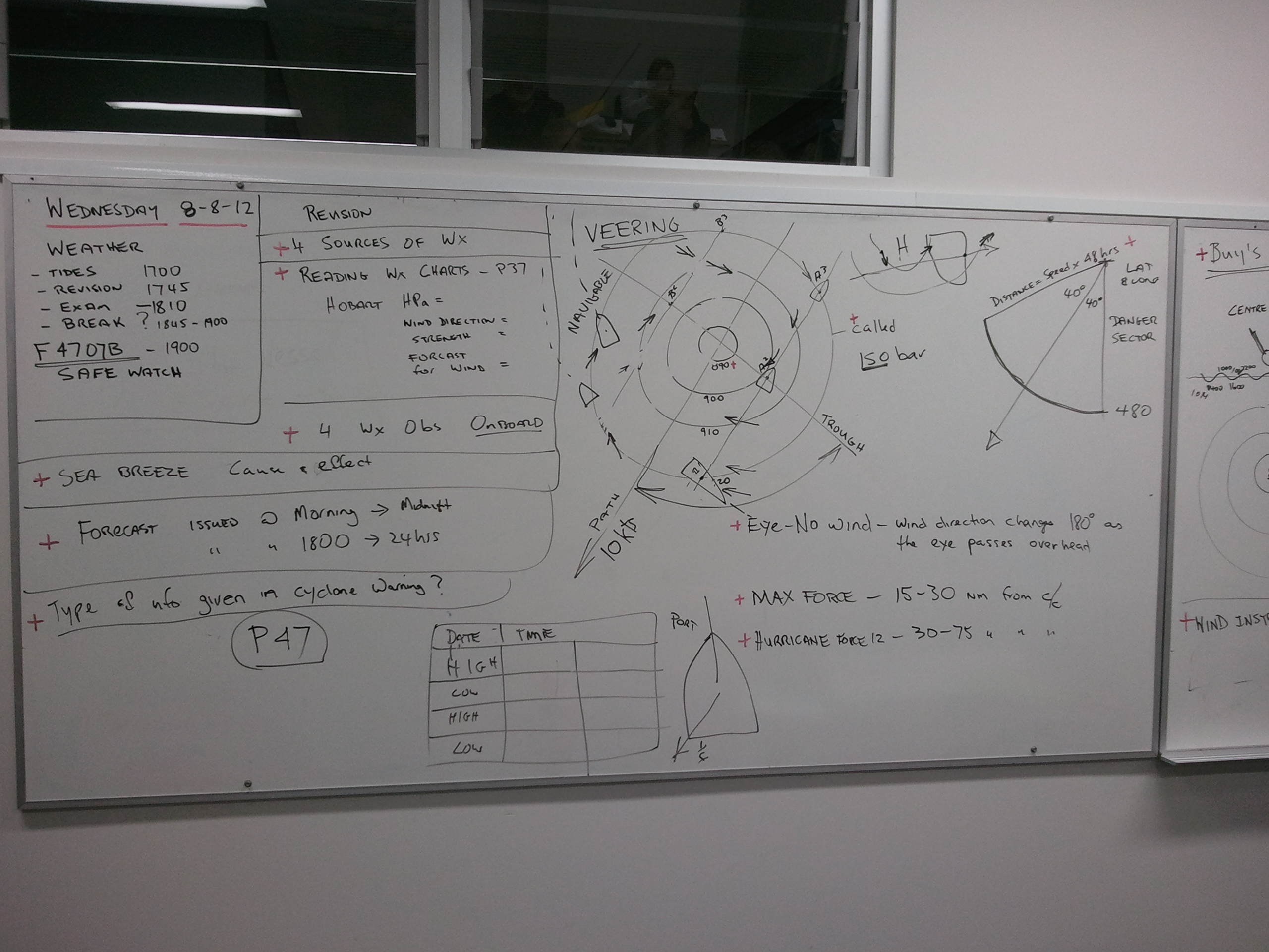
Weather was in most nautical subject, but had its very own subject too.
Receiving weather via Weatherfax:
• You must deduct 1.9 kHz off the listed frequencies.
• To receive a good Weatherfax is easy, but the atmospherics can cause disturbances. Ensure you have done everything you can to receive a good picture.
• Turn off EVERYTHING:
• the fridge
• wind generators
• solar panels
• inverters
• electronic steering gear (get someone to hand steer for a while or use the wind vane)
• all electrical devices
• solar panels (install a switch that lets you manually turn them off)
Deciphering pictures:
We like the synoptic charts as they show you why the wind is doing what it is doing, and it can show you an escape route. You can clearly see what is coming.
• Download the worldwide frequency list from here.
• Do not forget:
• Subtract 1.9kHz from the given frequency.
• Some of the listed times are not exact and can change.
• Faxes can come a few minutes earlier and often later than the scheduled times.
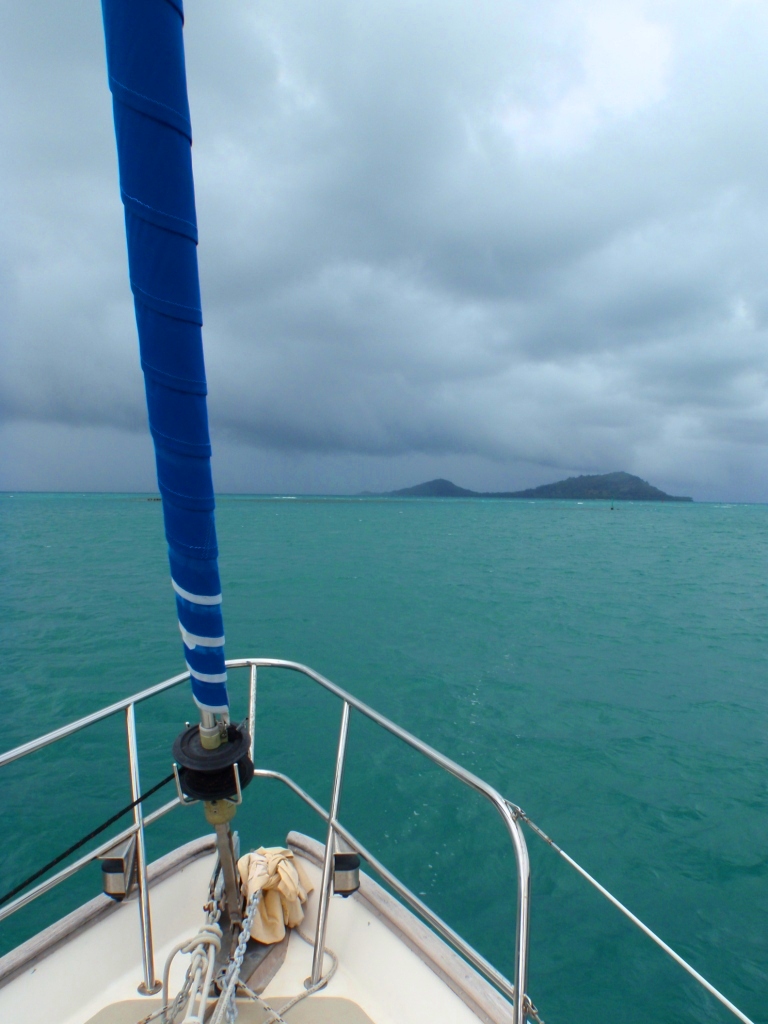
Weather watching at the Gambiers, where a dip in the isobars gave us a good-hiding!
Other boats downloaded weather that was more detailed, but to specific area. It didn’t show the big picture. They could see what would happen today and tomorrow but not long term, whereas we could view a front coming for 5 days, (and we did!) It is amazing to see it on the weather fax then on radar then visually! And then feel its impact!

Wind/wave chart for same area as synoptic chart.
Note: That the wind chart stops at 30°N – so you can’t see the gale that is on the synoptic chart!
More Information:
Cruisers’ AA (accumulated acumen) has all this information and much much more. It is now available on Kindle for not much more than a decent cup of copy. (No.5 on the bestseller list! – Amazon)
Of Foreign Build – is also available on Kindle and paperback (and has just become the No. 1 best-seller in its category! – Amazon)
More about us: Noel and I have sailed thousands of ocean miles and have worked internationally on commercial boats – in Australia we taught commercial maritime and all our accumulated knowledge through recreational and professional sea-miles is incorporated into Cruisers’ AA.

Me on a practical assessment for radar and navigation – I always asked students to interpret the weather.

October 26, 2014 at 7:27 am
Those whiteboard pictures bring back some great memories…
LikeLike
October 26, 2014 at 4:07 pm
ha ha! don’t they – for us too! Are you home safely Mike?
LikeLike
February 16, 2015 at 6:01 pm
Saved as a favorite, great website!
LikeLiked by 1 person
February 16, 2015 at 8:16 pm
Thanks for stopping by – they’ll be some more useful boat stuff soon! 🙂
LikeLike
February 22, 2015 at 9:56 am
Hi Jayden, thanks for stopping by – I’ll be putting more on the site soon – been so busy. And I’ll be stopping by yours to take a look! 🙂
LikeLike