
These diagrams are included the paperback copy of Cruisers’ AA. They are NOT included in the Kindle edition due to their complexity. For ease of reading we have included them here for you to use, view, print out, whatever you wish.
At the end of the diagrams we have included some pictures that are included in the paperback version. We hope you like them.
Click on each heading below to go straight to diagram, or simply scroll through.
Dangerous and navigable semi-circles of a cyclone
Use of drogue in emergency steering
Navigation calculations: From compass to true and from true to compass
Double the angle off the bow (figures 1 & 2)
Speed, distance, time calculations (also, see formula below)
Chart symbols / chart conventions
Formula for speed, distance, time calculations
World-wide radio Nets and Scheds
=======================================================================================================================
Dangerous and navigable semi-circles of a cyclone
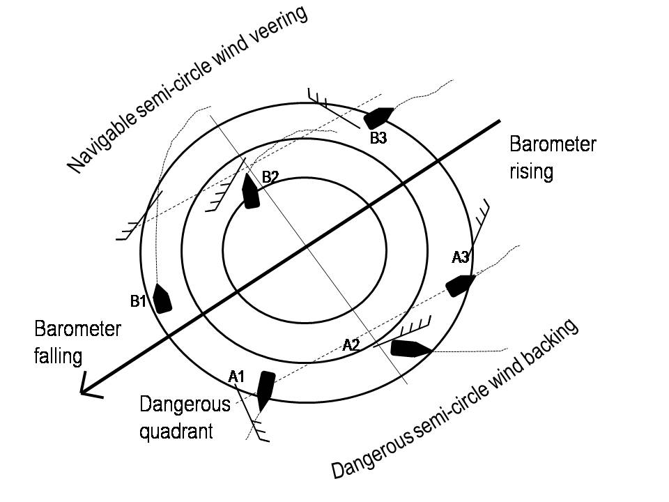 This picture is based on cyclones in the southern hemisphere. (Cyclones spin clockwise in the southern hemisphere, anti-clockwise in the northern hemisphere.) Therefore, the dangerous semi-circle of a cyclone is to the right of an approaching cyclone path. This area has the strongest winds and it is the direction the cyclone is expected to move.
To evade a cyclone: In the southern hemisphere, if you are in the navigable semi-circle, keep the wind on your port quarter and manoeuvre away from the cyclone. If you are in the dangerous semi-circle, keep the wind on your port bow and try to manoeuvre away from the vortex.
Remember, no part of a cyclone is safe. It is just that in the navigable sectors you have a better chance of escaping the path of the vortex.
In the diagram above, vessels at B1, B2 and B3 have a chance to run away from the vortex. Vessels at A1, A2 and A3 are in a perilous situation: if they run they will be sucked into the vortex. Therefore, they have to keep the wind on the port bow to try to get away from the vortex. Conditions will improve, believe it or not, by A3. From here keep heading NE until the cyclone dies out. (Note from Noel: ‘Then I’d run aground somewhere, climb a tree and never go back to sea!’)
=======================================================================================================================
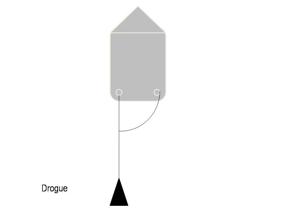
Use of drogue in emergency steering
=======================================================================================================================
Cocked Hat
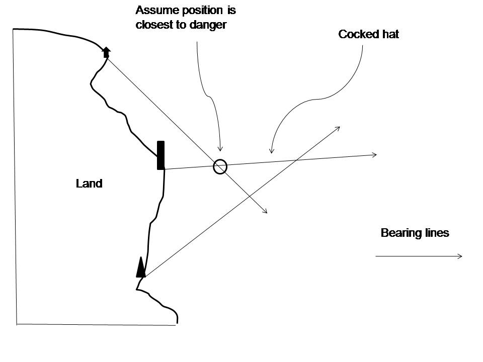 With three bearings, you may end up with a cocked hat where the three bearing lines meet (usually looks like a witch’s hat, as above. If it is not too big, mark your position in the cocked hat at the closest point to danger and have another go (in the picture it shows that position would be nearest to land. Cocked hats occur with errors (plotting, wrong identification of object, compass error incorrectly applied or unknown compass error), or this could occur with the imprecise reading of the compass or an unsteady hand when at sea.
=======================================================================================================================
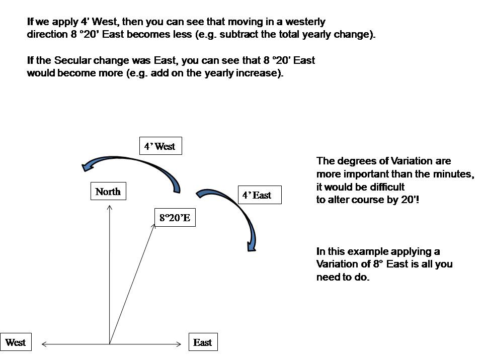
Navigation calculations: From compass to true and from true to compass
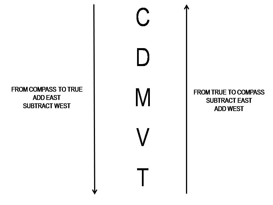
Above we have:
Written out CDMVT with arrows alongside
We know by using CADET, when going from Compass to True we ADD EAST (ADE). So draw a line pointing from C to T and write, next to this line ‘Add East’. If you add east you must subtract west – write this on the same side.
On the other side of CDMVT, draw a line with an arrow going in the opposite direction from the first arrow on the other side.
The instructions for East and West are the exact opposite. Therefore write subtract East, add West.
Simply follow the directions.
=======================================================================================================================
Variation Calculations
=======================================================================================================================
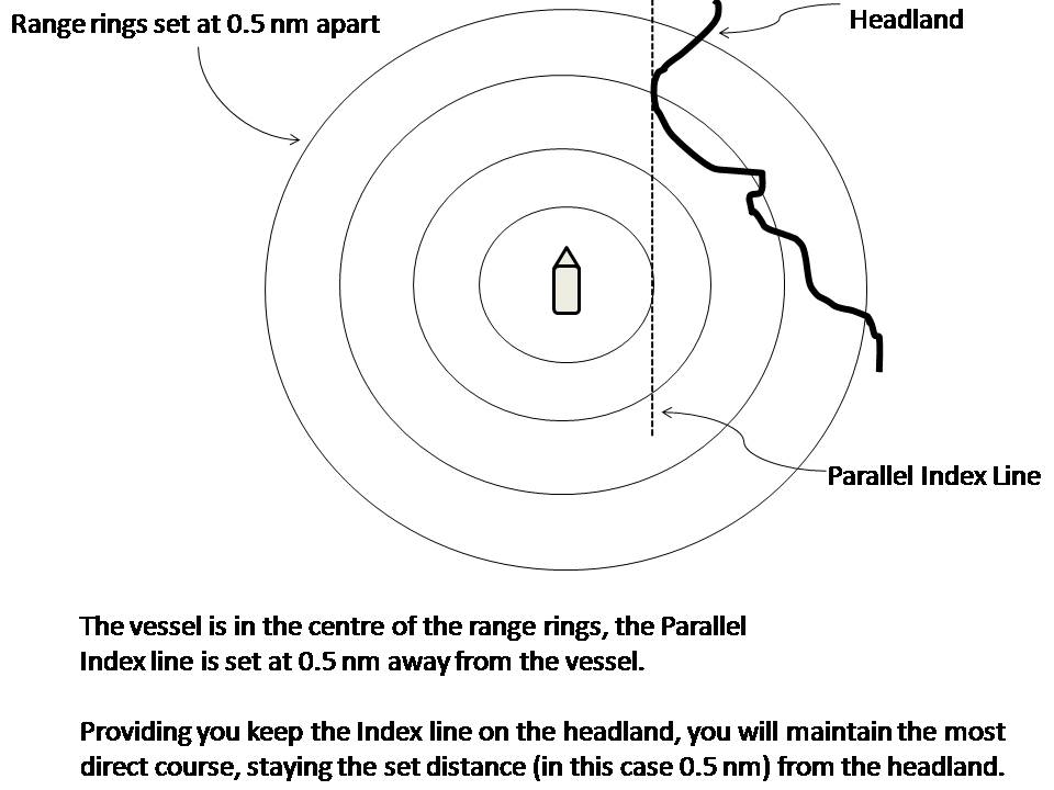
Parallel Indexing
How to do Parallel Indexing: You place a line at a chosen clearance range from the centre (your boat), parallel to your heading line and on the side where the obstruction/headland exists (using an offset EBL (electronic bearing line) or a PI (Parallel Index) line if your radar provides one). Use the VRM (variable range marker) to set the EBL/PI line at the appropriate distance and make sure you do not breach that line. (See diagram below.)
=======================================================================================================================
Double the angle off the bow. Figures 1 & 2.
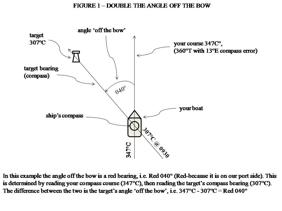
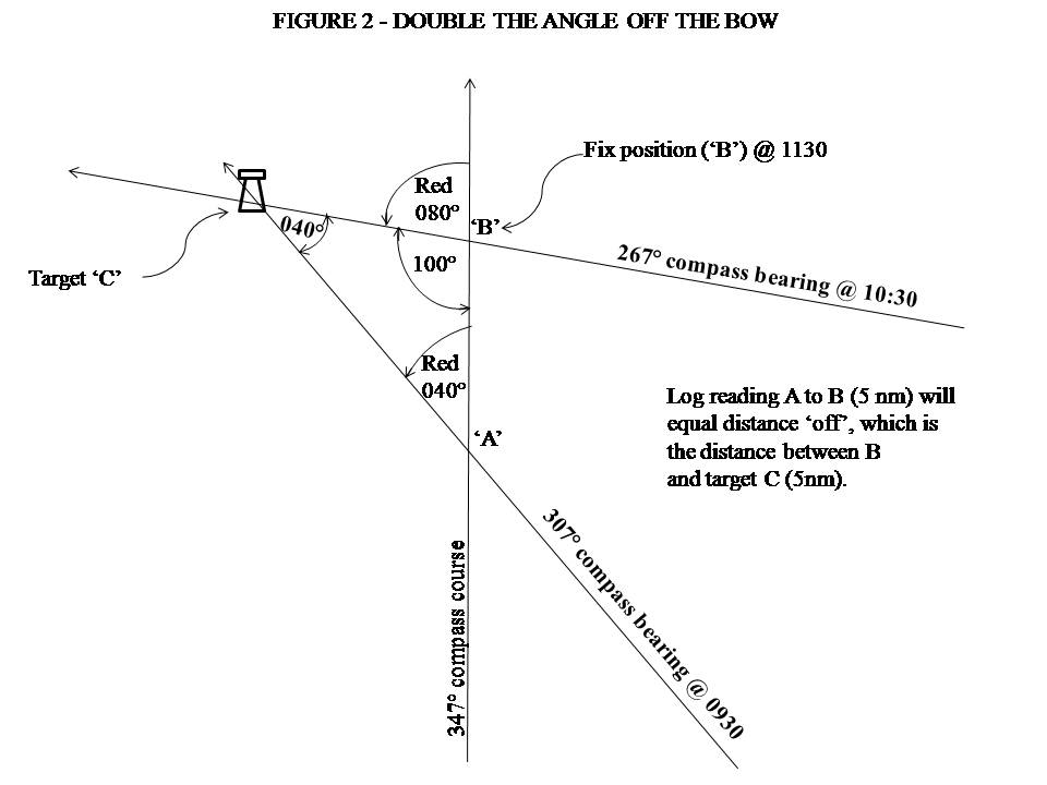
Follow the step by step instructions in the book!
=======================================================================================================================
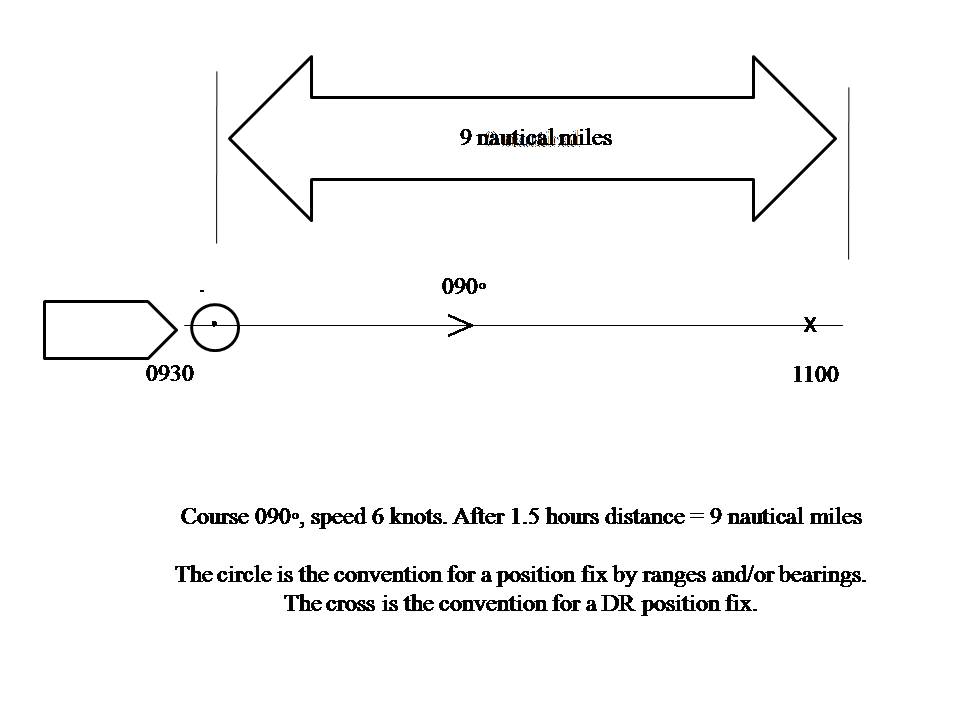
Speed, distance, time calculations
The following example is a vessel travelling at 6 knots for one and a half hours (see Speed, Distance, Time formula later in the book for more complex calculations).
=====================================================================================================================
 Follow the detailed, step by step instructions in the book.
Position – Running Fix
A running fix is a fix using two bearings and it doesn’t matter how far the course line is from the bearing object, therefore it is used when you have no means of measuring the range.
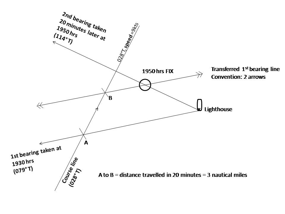
See full step by step instructions in the book.
=======================================================================================================================
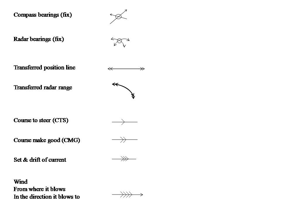
Chart symbols / chart conventions
On the chart, use the following symbols so everyone understands the workings.
=======================================================================================================================
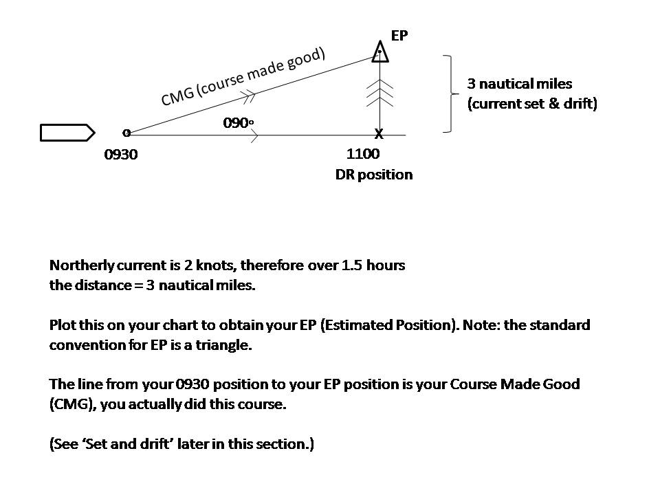
Set & Drift
Current will push you in a certain direction (called ‘set’) and over a period of time, the current will move you a distance (called ‘drift’). To counteract set and drift, you need to know the speed and direction of the current. (You could do this by taking a good fix position and comparing that position to your DR position. The difference between your good fix and DR position will be the set and drift).
Finding the Course to Steer (CTS) allowing for a known current:
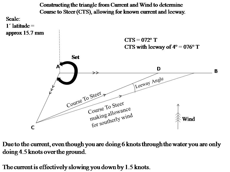
For full, step by step instructions, see the book.
=======================================================================================================================
Formula for speed, distance, time calculations
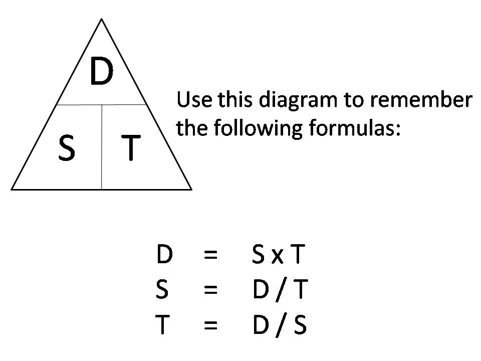
See the book for further instructions
=======================================================================================================================
True wind calculations
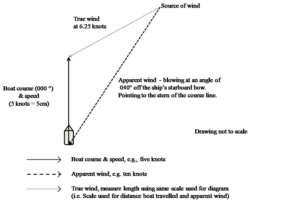
For full details, follow the instructions in the book.
=======================================================================================================================
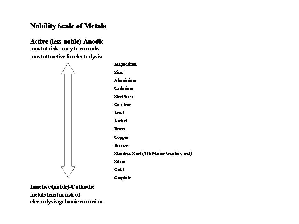
Nobility Scale of Metals
 =======================================================================================================================
World-wide radio Nets and Scheds
| NAME | TIME | FREQUENCY | AREA COVERED |
| Sonrisa Net | 0730 hrs (PDT) | 3.968 MHz | Sea of Cortez |
| Russell RadioNew Zealand | 1800 hrs (NZ)1830 hrs (NZ)1900 hrs (NZ) | 6.516MHz4.445 MHz4.417MHz | South Pacific |
| New Zealand Wx Net | 2000 hrs (Z) | 7.080 | New Zealand |
| Med M/M Net | 0700 hrs (Z) | 7.085 MHz | Mediterranean |
| Comedy Net | 2040 hrs (Z) | 7.087MHz | Australia, South West Pacific(very informal – multipurpose) |
| Harry’s Net | 2000 hrs (Z) | 7.095 MHz | W & S Pacific |
| Baja California M/M Net | 1530 hrs (Z) | 7.238 MHz | Coastal Baja & California |
| Caribbean M/M Net. Saint Croix | 1100 hrs (Z) | 7.241 MHz | Caribbean |
| Chubasco Net | 1445 hrs (Z) | 7.192 MHz | Mexico West coast |
| The Namba Net | 0815hrs local time Vanuatu (Z + 11) | 8.101 MHz | Operates May to October, sister Net to Sheila Net |
| Radio ‘Peri-Peri’ E. Africa | 0500 hrs (Z)&1500 hrs (Z) | 8.101 MHz then,12.353 MHz (after weather) | Indian Ocean & South Atlantic(both times, both frequencies) |
| Caribbean Safety & Security Net | 1215 hrs (Z) | 8.104 MHz | Safety & Security issues in the Caribbean |
| Panama Canal Connection Net | 1330 hrs (Z) | 8.107 MHz | Pacific from Mexico to Galapagos, Atlantic from Belize to Colombia (emphasis on SW Caribbean) |
| Panama Pacific Net | 1400 hrs(Z) | 8.143 MHz (Alternatives: 8.137, 8.155,6230) | Panama to Galapagos (depending on propagation – Southern Mexico to Ecuador too) |
| Cruiseheimer’s Net | 1330 hrs(Z) | 8.152 MHz | US East Coast & through Eastern Caribbean |
| Sheila Net | 2200 hrs (Z) | 8.161 MHz | NE Australia, New Guinea, Louisiade Archipelago, Solomon Islands, Vanuatu and Noumea |
| Rag of the Air Net | 1900 hrs (Z) | 8.173 MHz | SW Pacific |
| Northwest Caribbean Cruisers Net | 1400 hrs (Z) | 8.188 MHz | Mexico to San Andres Island, Colombia |
| Coconut Breakfast Net | 1730 hrs(Z) | 8.188 MHz | French Polynesia |
| Coconut Breakfast Net | 1830hrs (Z) | 12.353 MHz | West of French Polynesia |
| Herb Hilgenberg’s Southbound II Net | 1930 hrs (Z) | 12.359 MHz | Atlantic & Caribbean (reaches into Pacific later in the broadcast) |
| French Net | 0300 hrs(NZ) | 13.940MHz | French |
| ‘Le Reseau Du Capitaine’ Net Montreal, Canada. Bi-lingual operators | 0700 hrsMontreal time 1830 hrs Montreal time (emergency traffic & weather) | 14.118 MHz | Atlantic, Caribbean and Pacific |
| Mississauga Net | 1245 hrs (Z) | 14.122.5MHz | Europe, Med, Atlantic, Caribbean & Central America |
| European M/M Net (Italian and English) | 2000 hrs (Z) (1900 hrs (Z) between 30/3 & 20/10) | 14.297 MHz | Weather for E & N Atlantic & S Atlantic between Africa & Brazil |
| M/M Service Net | 1700 hrs (Z) during winter 1600-0200 hrs (Z) in summer | 14.300 MHz | Atlantic from Cape Town to Greenland, the Eastern Pacific & Gulf of Mexico |
| UK M/M Net | 0800 hrs (Z)& 1800 hrs (Z) | 14.303 MHz | UK, Med and Atlantic |
| Confusion Net | 1900 hrs(Z) | 14.305 MHz | Pacific |
| Pacific Seafarers Net | 0300 hrs (Z) | 14.300 MHz | Pacific (HAM) |
| Robby’s Net, Australia | 1000 hrs (Z) & 2300 hrs (Z) | 14.315 MHz | Australian waters |
| Tony’s NetNew Zealand | 2100 hrs (Z) | 14.315 MHz | South Pacific, Australia AreaHAM Net |
| Pacific Inter Island Net | 0800 hrs (Z) | 14.315 MHz | Micronesia to Hawaii |
| Tony’s Net, Kenya | 0500 hrs(Z) | 14.316 MHZ | Indian Ocean and Red Sea |
| South Africa M/M Net | 0630 hrs (Z) &1130 hrs (Z) | 14.316 MHz | Indian Ocean & South Atlantic |
| Arnold’s Net (South Pacific) | 0400 hrs(Z) | 14.318 MHz | South Pacific |
| SE Asia M/M Net | 0025 hrs (Z)0055 hrs(Z) | 14.323 MHz | SE Asia |
| California Hawaii Net | 1600 hrs(Z) | 14.340 MHz | Pacific E, NW and Hawaii |
| Manana M/M Net | 1900 hrs (Z) | 14.340 MHz | US West Coast to Hawaii |
| Trans Atlantic Net | 1300hrs (Z) | 21.400 MHz | Med, N & S Atlantic & Caribbean |
Zulu (Z) = Greenwich Mean Time
M/M= Maritime Mobile
=======================================================================================================================
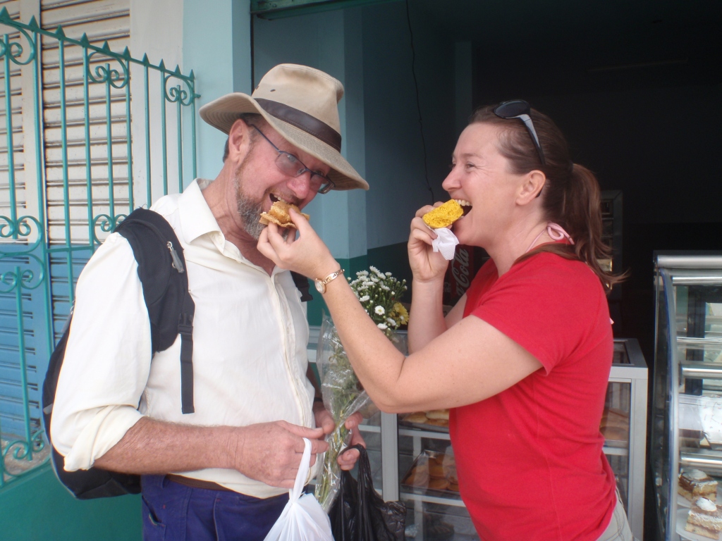
Photos of our journey
Pictures of our journey – relating to Cruisers’ AA short stories (scroll down). There are more pictures of our travels under OUR BOOKS/OF FOREIGN BUILD – follow the links from our home page:
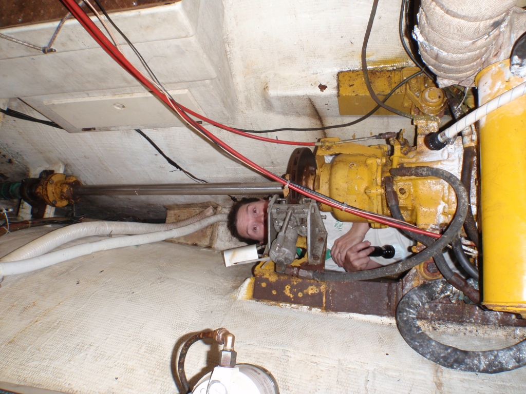
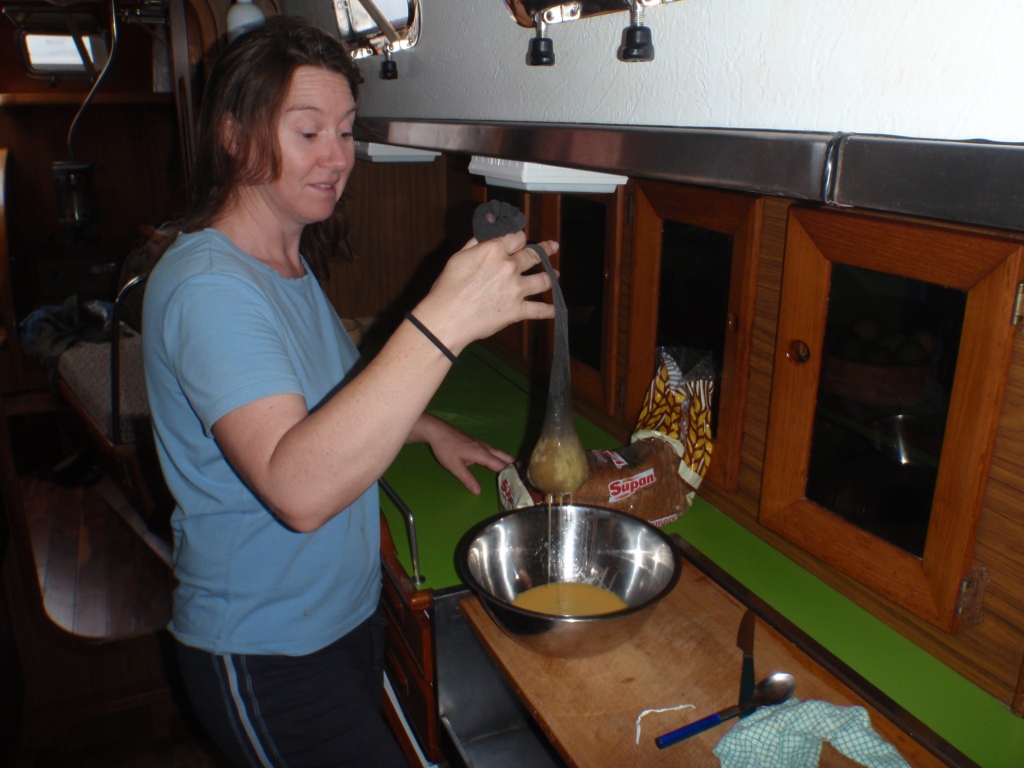
Jackie under Pyewacket’s engine. The white powder is talcum powder, as we are searching for a water leak.
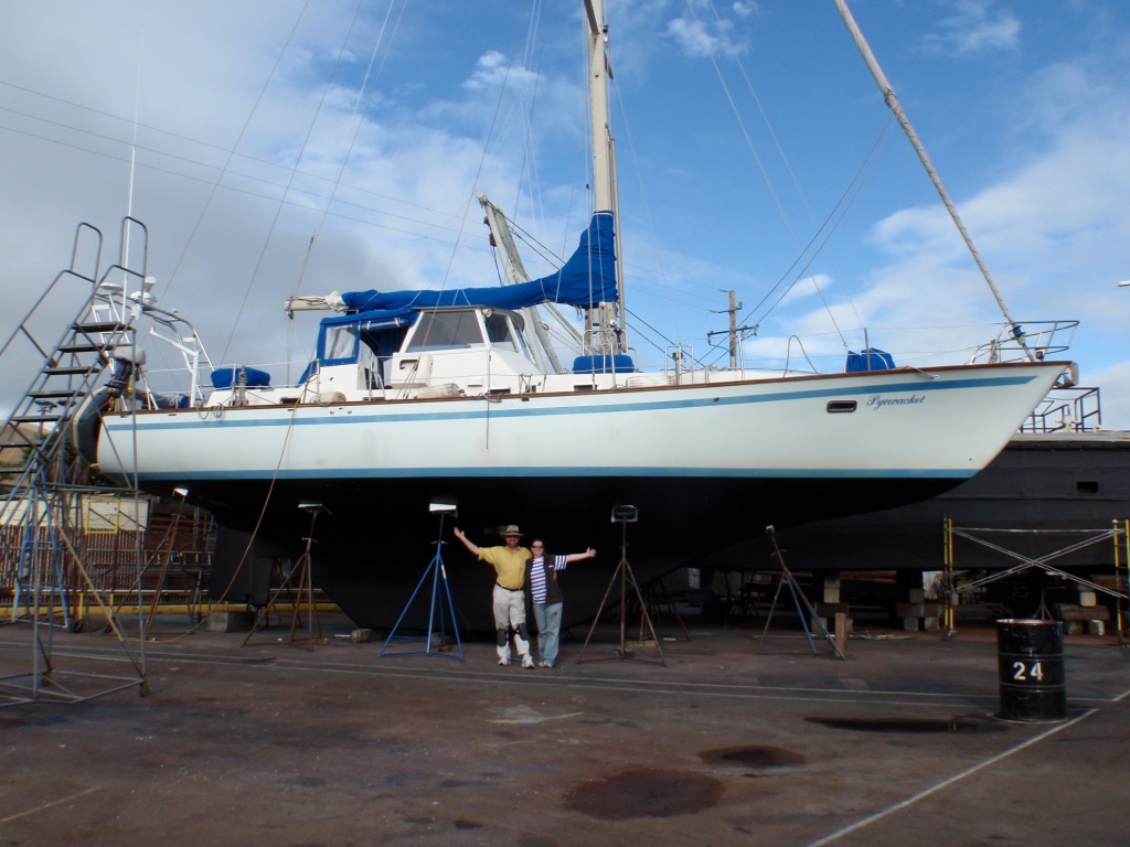
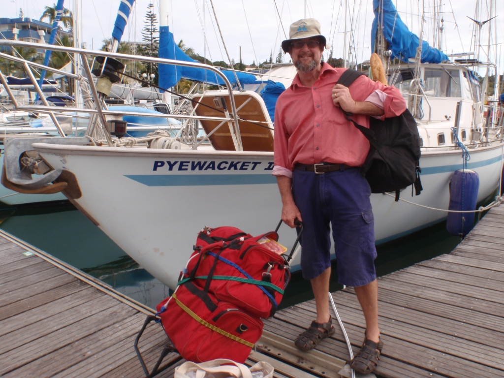
The lovely Pyewacket II
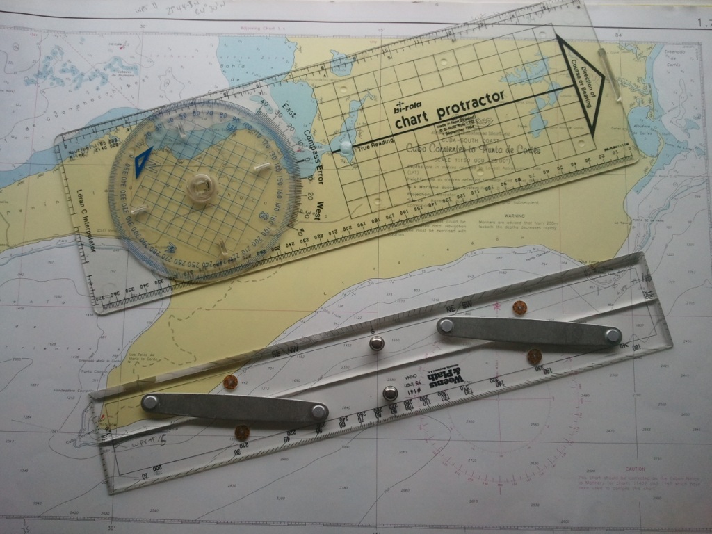
Tools for navigation
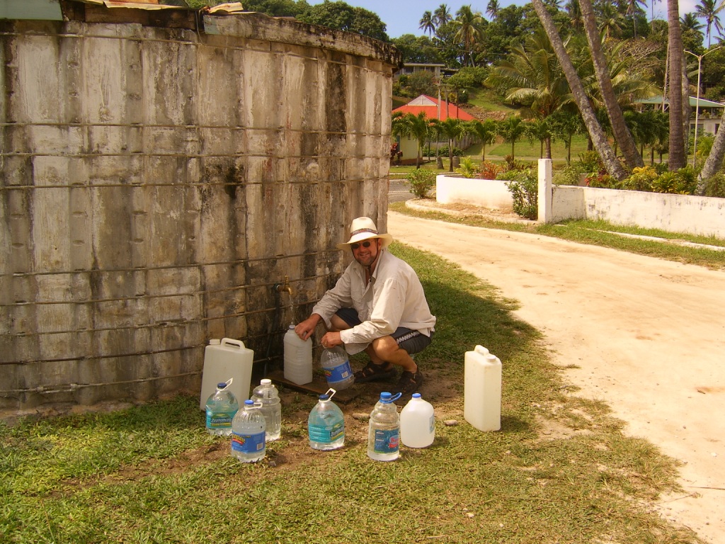
Noel at Aitutaki – collecting water.

Wing on wing on Mariah
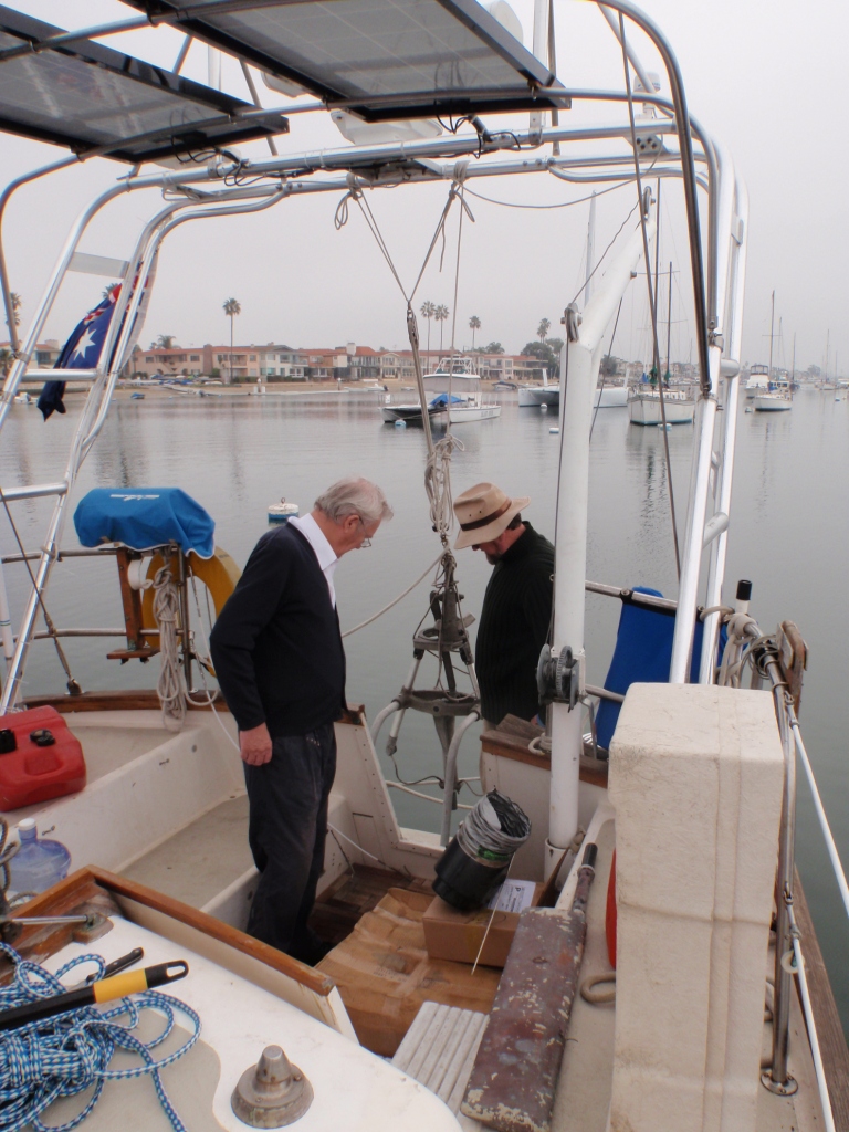
My dad and Noel, giving the new Aries a ‘good coat of looking at’ (mounting the Aries)
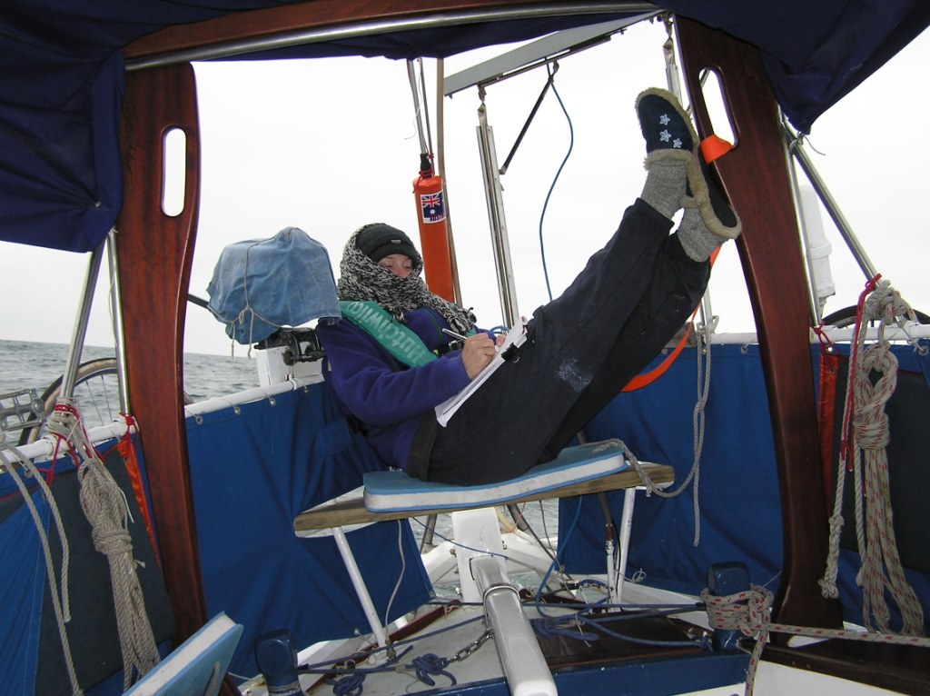
I love writing and do it anytime, anywhere! (On Mariah)
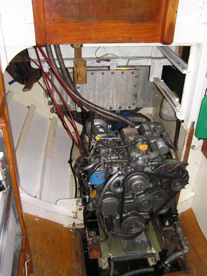
Mariah’s pristine engine – we painted the ‘engine room’ to make a brighter area to work in.

Crew member – Michael – during the Panama Canal – on board Mariah
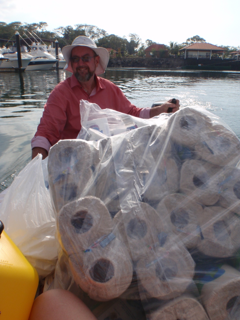
Stocking up on kitchen roll and loo paper – for Pyewacket’s trip across the Pacific
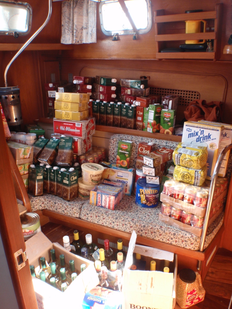
More stocking up – wines and staples
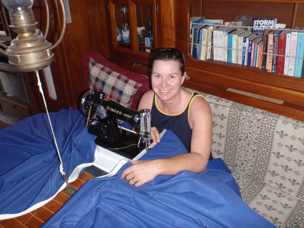
A sewing machine was extremely useful – Jackie is making a large shade tarp for Pyewacket

A pretty neat office in Mexico!

Noel installing hatches in our hard dodger – en route to Isle de Cocos! Note he is harnessed on!
We had our anchor chain galvanised in Eucador, by hand!
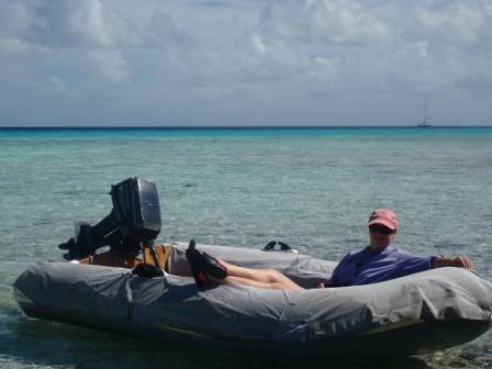
At Tahanea Atoll, Pacific – having a chillin’ moment – you can just see Pyewacket over my left shoulder!
In Ecuador (Bahia de Caraquez) the cakes were just pennies!
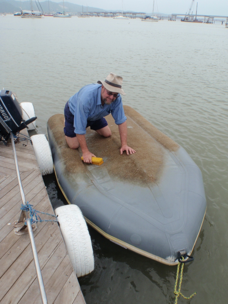
In Bahia de Caraquez there was plenty of growth on our dinghy – Noel cleaning
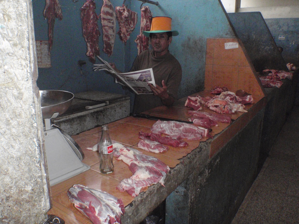
Shopping at the markets in Ecuador – sometimes you have to be brave!

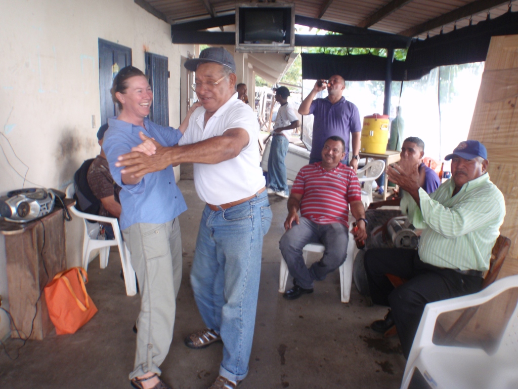
Noel dancing with the locals at Moorea – near Tahiti
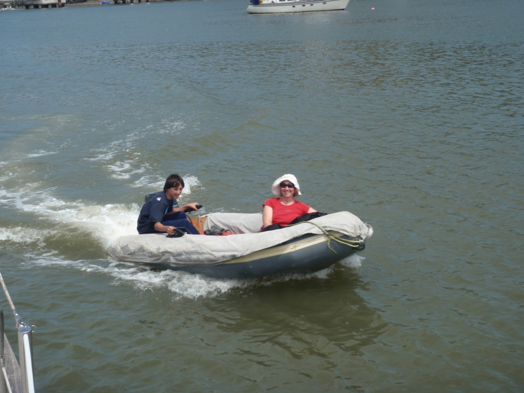
My nephew Kieran came to visit us (with my dad) in Ecuador, he had great fun learning to steer the dinghy.
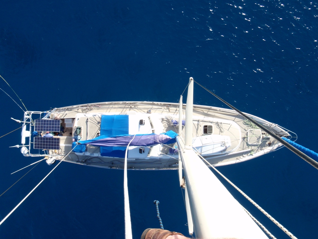
Noel up the mast on Pyewacket
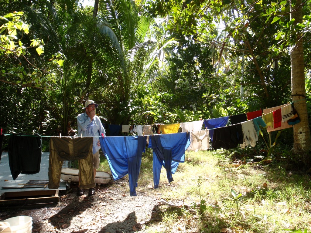
Hanging the washing out in Sawarrow
I like wearing sarongs, in Samoa so did Noel as everyone wore them – It just isn’t right, though, when your man looks better in a skirt than you!
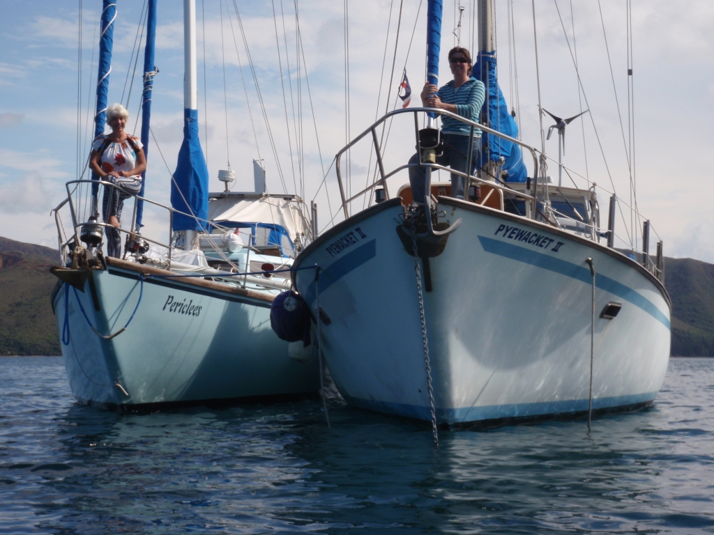
Rafting up in New Caledonia with Pericles – fun times!
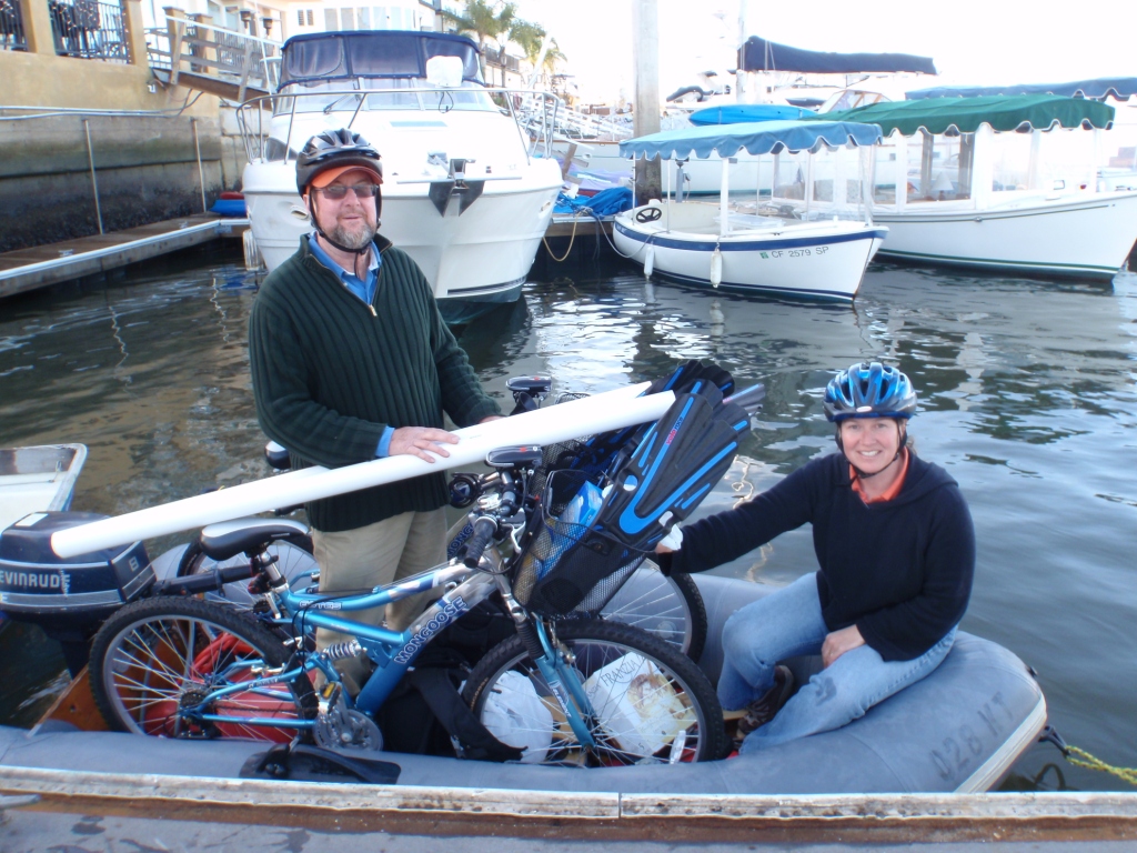
A trolley is important when you don’t have a car!
The lovely Rolande from SV Pericles …. showing how important shade is! (At New Caledonia)
Saving eggs! How come? Cruisers’ AA will tell you all about it!
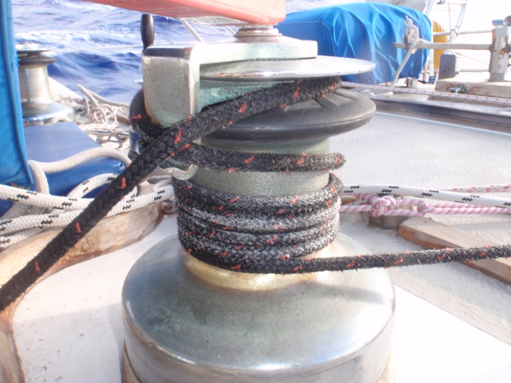
Wash your lines in fresh water when you can after a trip – the salt doesn’t do them any good!
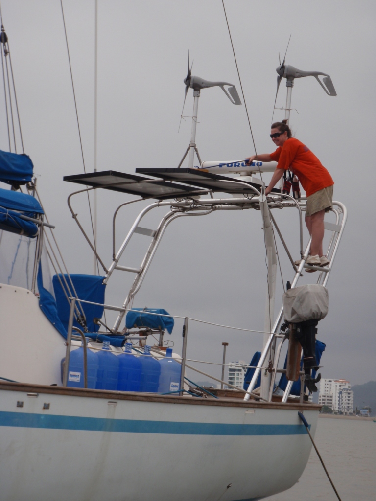
Clean solar panels regularly to get the best from them – a soft cloth and liquid detergent (small amount) works well, don’t use anything abrasive – notice the wind generator blades are lashed down.
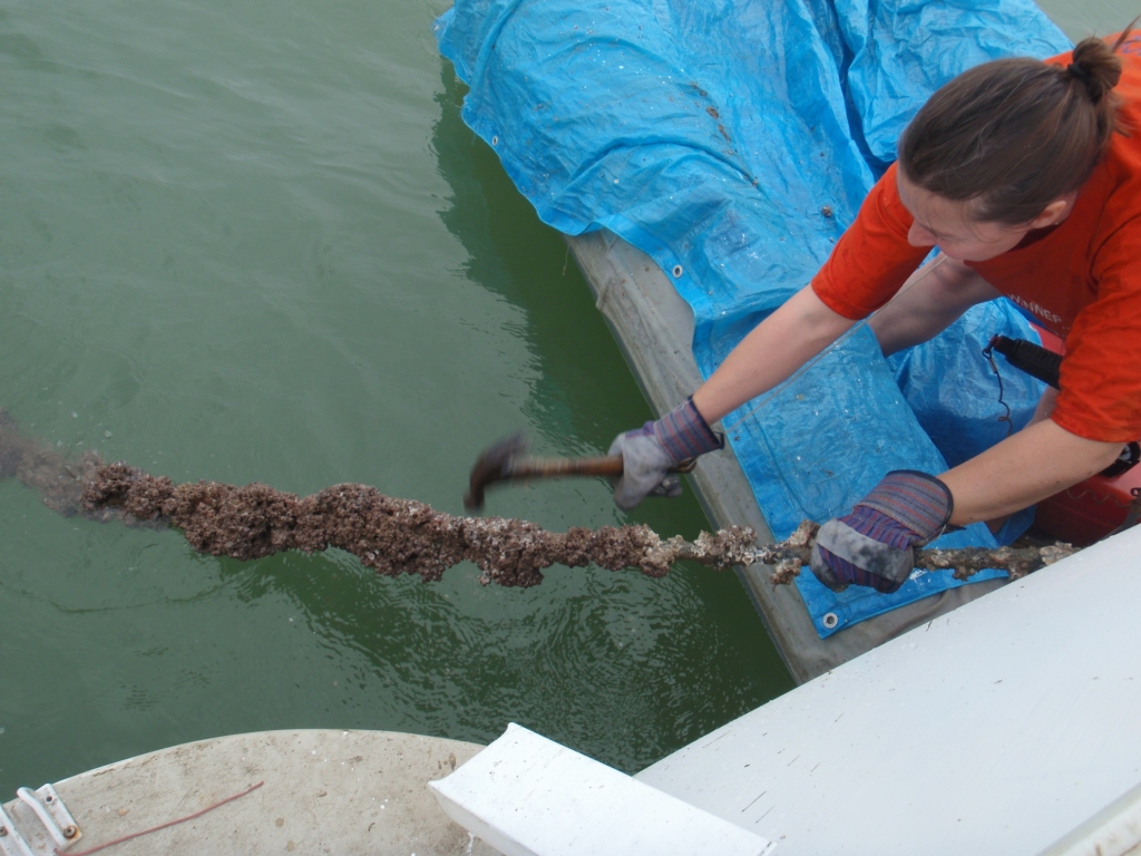
After 8 months in Ecuador, our lines were encrusted – it took a hammer and a whole day to clean them off – imagine how our prop looked!
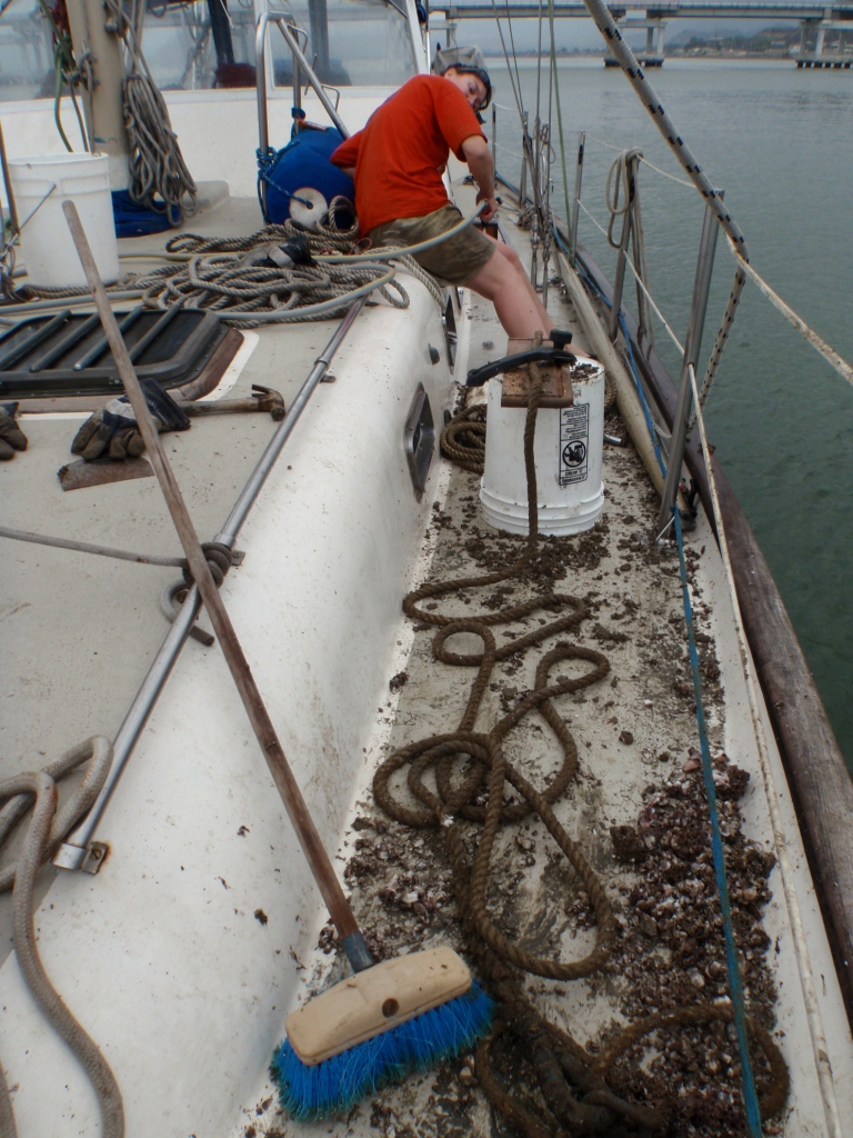
It was hard to get all the shell out of our lines – It wouldn’t have done them any good at all!
Your dinghy becomes your car – it needs looking after – Cruisers’ AA tells you how to make quick and easy covers and how, if you lose your dinghy how hard it is to replace it – Noel ended up working in a brothel in Barbados to get our new dinghy together – you’ll have to read the book!
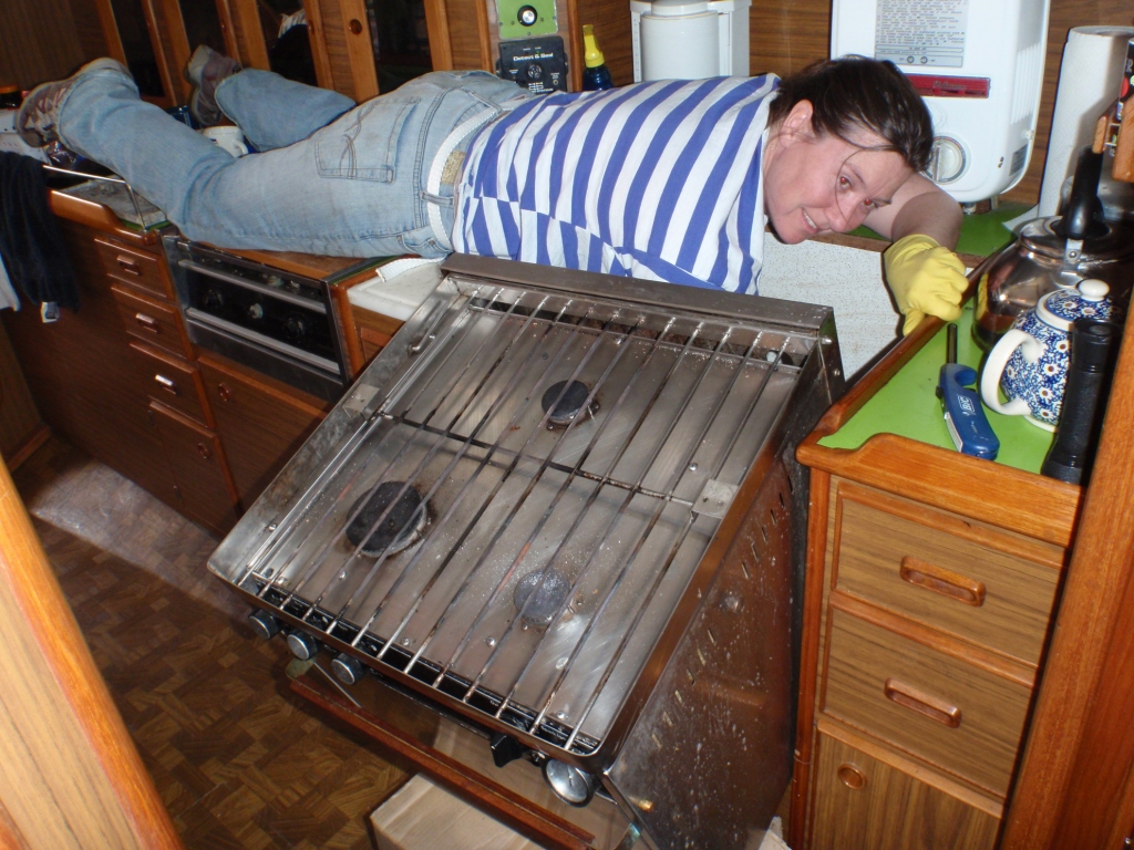
Cleaning behind the oven was an interesting exercise in Pyewacket!
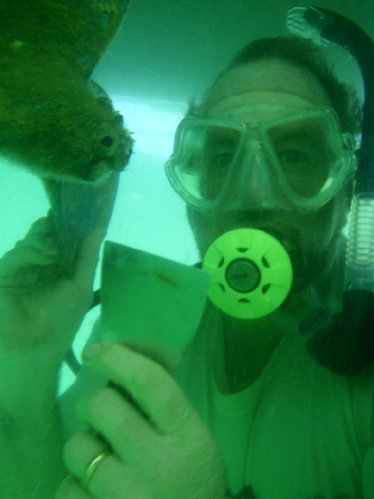
Work never stops – but a dive hookah is a good idea, especially if you have a deeper keel.
Checking in can be a chore – but sometimes fun. We arrived into Panama on Pyewacket on the 31st December – while we waited for the officials, the men outside the office gave us a beer, put on some music and we had a dance! fabulous!

May 5, 2016 at 7:57 am
Jackie
I am learning so much from Cruisers AA, and have really enjoyed your books. Thanks for all! Maybe someday we’ll meet out there on this water planet.
LikeLike
May 13, 2016 at 7:56 am
Thanks Kim, for your lovely words – they are very much appreciated. I also noticed you are somewhat ‘horsey’ too (via your website) – I’ve sent you an email as I’d love to chat more on both boats and horses!
LikeLike
November 18, 2017 at 1:07 am
Enjoyed your posts.
LikeLike
November 18, 2017 at 7:09 am
Thank you!
LikeLike